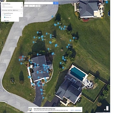
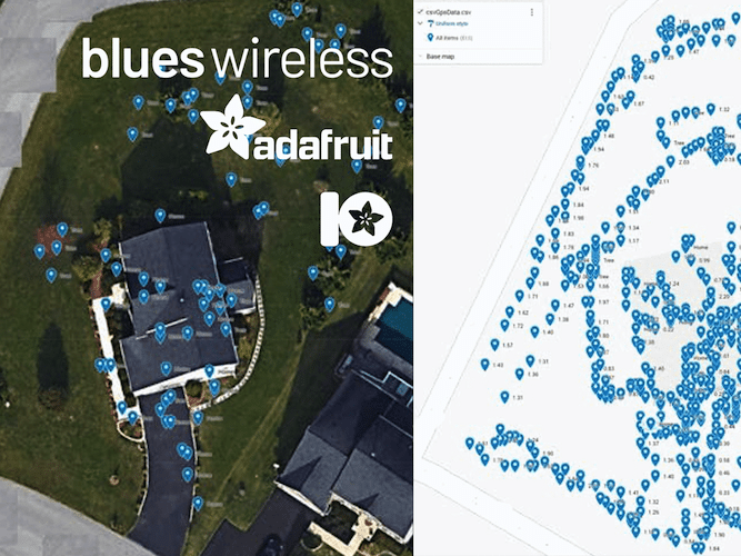
Irak Mayer wanted to map out his yard for potential lawn-mowing automation. To do so, he needed a system that could capture geospatial features (trees, driveway, etc), signal strength and location, and then transmit that data to a cloud service.
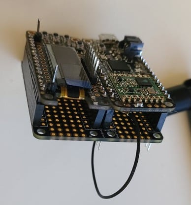
Irak ended up using an Adafruit Feather Wing Ultimate GPS for capturing precise location, and a Wi-Fi Notecard to send that data up to Adafruit.io for displaying on a map.
Additionally, Irak set up a Feather Wing Doubler so he could run connect two feather boards to a Notecarrier-AF. He used this to hook up both a Feather M0 RFM69 for processing, and a Feather Wing OLED for a visual status display as he was mapping his yard.
Overall, the project is an interesting example of using the Notecard to help map out and tag a property. If this sounds interesting, make sure to check out Irak’s full writeup on Hackster.